
The first step in the port call process is that an agent requests a berth, orders services and gets a slot from the port. This is covered in the new web portal for agents connected with Grieg PMIS, which is complementary to authority-mandated single window reporting. In the next step for project cargo, cruise ships, and other larger vessels, ports often create what is called a mooring plan, which they then send to shipping companies, agents, and skippers.
The mooring plan was first introduced in the program Shiplog and has been in use for years. The users select the vessel, berth, time frame, and then adds bollards and other relevant information in a map-based view. This is then shared with stakeholders via email.
The need, however, for added precision, process automatisation and seamless data sharing, has led to the traditional mooring plan being taken to the next level and migrated into PORT.
“The mooring plan has worked well for Nordic ports for many years. I am happy that we are now delivering significant improvements to this for our users”


Mooring Plan 2.0 – Data Sharing
The first step in modernising the traditional mooring plan was to migrate it from Shiplog into the PMIS named Port. The functionality is thus available regardless of which machine you are using and can be accessed from anywhere with internet.
A common calendar view, a common graphic view for arrivals and visual mooring plans will be available to all arrival actors at the port using the webportal.
“Easy data sharing among the actors working at the port and those who are going to arrive is important to us, especially with events like Tall Ships Race and Arendalsuka leading to many visitors . The new mooring plan combined with the port portal is a good example of how we can work better and more accurately with arrival planning,” Gordon Fuglestad, Arendal Port.
Mooring Plan 2.0 – Accuracy
Precise scans carried out by laser scanning firms and surveyors find their way to Port ensuring that all assets are georeferenced showing a digital replication of the port . Assets can for example be quay fronts, ladders, bollards, warehouses, cranes, fences etc., On top of these assets a wide range of services be be built with laser sharp accuracy such as the mooring plan:
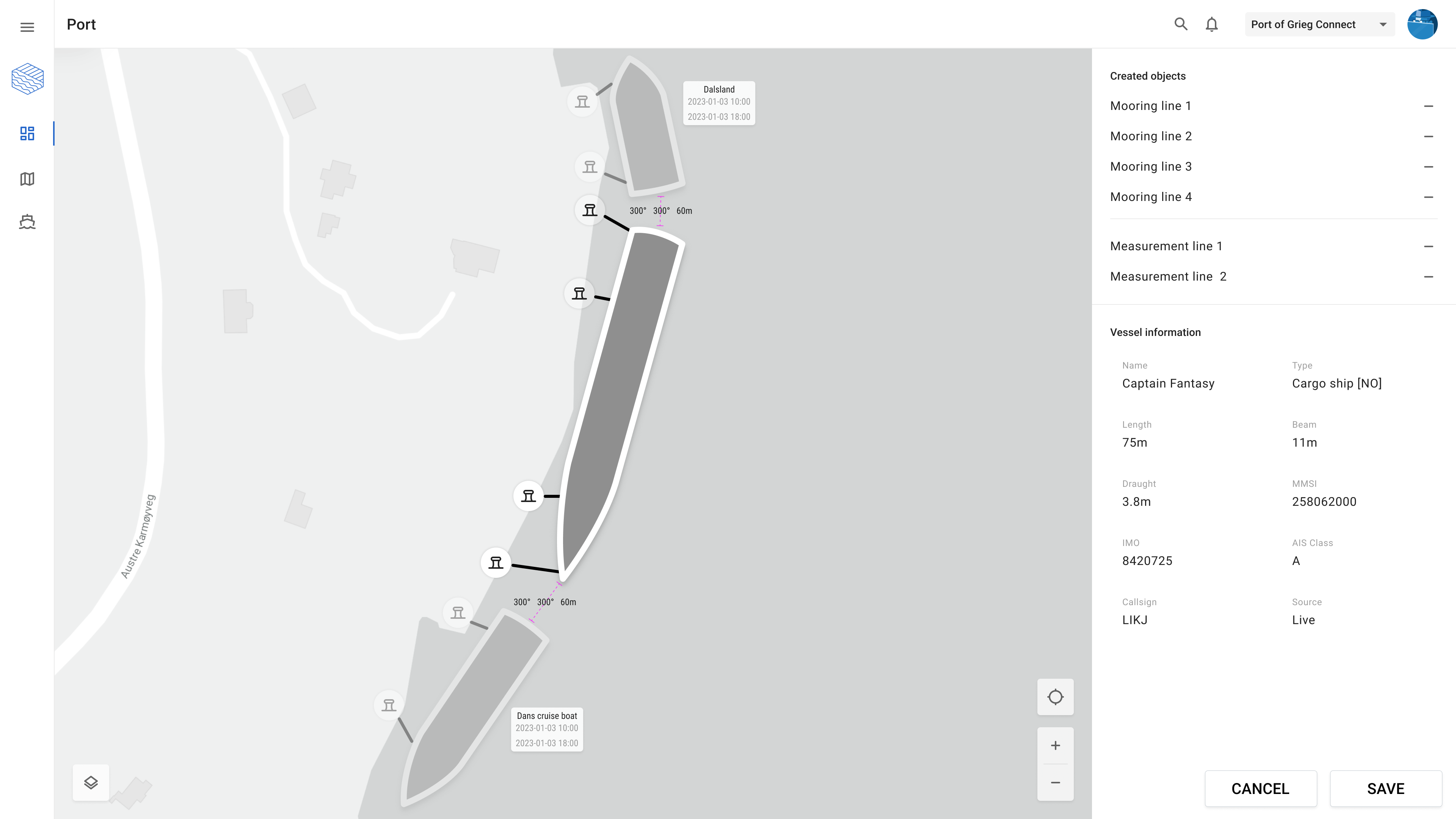
This automation and GIS functionality ensures that georeferenced, accurate and updated data is always available for use in a mooring plan. In addition quality-assured vessel data from Port will be a good complement to AIS data that is often lacking in quality. All of this is available online with modern interfaces for sharing and collaboration among the actors working on a port call.
For more information on how to get started with the functionality or Grieg Connects PMIS please contact our friendly team