
The project “Norwegian Digital Port Infrastructure” kicked off just before Christmas. With € 2,6 million from the Norwegian Coastal Administration (NCA) and workgroups in place, the work now commences to make ports more effective and greener. The first milestone has already been reached, the visualisation of port assets in Grieg Connect’s Port Information management system (PMIS).
NCA earmarked € 2,6 million for the project Norwegian Digital Port Infrastructure to enable more efficient port calls. The project, comprising work packages: Port data, Port security, Operational tools, Industry standardisation and implementation has set sail and will run until November 2022.
The project builds on the competency and technology developed in three nationwide initiatives with stakeholders from ports, the Norwegian Mapping Authority and Grieg Connect. These initiatives are now gathered into one continuation expanding on the in-place digital foundation and adding a layer of smart IT tools to be rolled out to all users of Grieg Connect’s PMIS.
The asset data in the Norwegian Mapping Authority’s database forms the foundation for the digital infrastructure. By making this available for viewing and editing in the PMIS, ports will easily be able to update their own data. Non-sensitive data will be available in the database forming the basis for new national services for all sea going traffic. Classified asset data will be restricted to internal use in the PMIS.

Easy to update
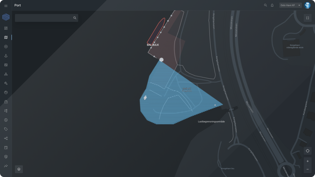
First out is the work package “Port data” making assets data from the Mapping Authority’s database available in Grieg Connect’s PMIS. Examples are harbour areas, quay fronts, bollards, safety ladders, emergency stations, water posts, shore power facilities, fenders, fences, and crucial operational data such as load limitations.
Disclosing assets via an interactive map and adding simple-to-use tools in the PMIS ensure that the Norwegian Mapping Authority’s database is frequently updated for the benefit of all stakeholders.
The ports in the project have worked closely with the developers and are very much looking forward to use the solution. Once a port’s assets are digitised; they are displayed in the mapping tool. Activities and resources are always available bringing potential to simplify port calls operations.
Hege Berg Thurmann, Project owner, Port of Oslo
Display of port assets in map
A new version of the PMIS, Port, including a collaborative asset and traffic map is now available for all ports using the solution.
The interactive map where you can view, measure and update objects, is the start of the digital twin we know ports want. Our PMIS map solution provides an overview of everything that happens in the port in one and the same solution,”
Anne Cecilie Rueness, Product Owner Port, Grieg Connect.
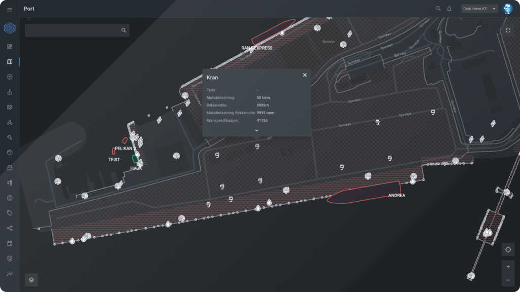
Port asset data can also be accessed on the go. If a port worker is out on the quay with a mobile phone, load limitations (or any other characteristics of the given assets) can easily be checked. Using GPS, the location is shown as we are used to from other services. A user can also easily turn on and off what types of objects that should be visible. This map will be the foundation of the ports’ future digital twin.
Live vessel traffic is shown in the same map and gives users an overall picture.
Smart tools built on the asset data
Additionally, the work package is about offering a great user interface making it easy for ports to maintain data. The solution is fully compatible with the Mapping Authority’s 2.0 version of the port asset registration guide, which contains data model updates and several new object types.
When work package 1 is completed, operational tools will be built on top of the port asset data. Functionality related to port security and ISPS will be expanded on. In addition, digital quay and service ordering replaces emails, map and calendar views provide better planning, and mobile tools make everyday life easier for those who work out on the quay.
For more information on how our Port Management Information system (PMIS) can help you streamline your operations, dont hesiste to get in touch
The nine ports participating in the projects are: Port of Arendal, Port of Oslo, Port of Kristiansund and Nordmøre Port Authority, Port of Båtsfjord, Port of Kristiansand, Port of Bergen, Karmsund Port Authority and Trondheim Port Authority. Port of Oslo functions as the project owner and The Norwegian Mapping Authority participates with the project manager.
Grieg Connect, solution provider of a Port Management Information System to more than 50 ports, develops the digital solution to be made available to all ports.